Monitoring and objects localising system WayGo
 WayGo is a monitoring and objects localizing (i.a. cars, vessels and people) system which uses the Global Positioning System (GPS). It is able to localize objects in real-time, store the history of company cars’ movements and stops’ time and manage the fleet efficiently. Additionally, the system increases security due to the possibility to localize monitored objects, informing the owner about any dangerous situations by means of text messages. Spotting any movement or leaving any defined area gives time for reaction in case of theft. Data in the system is transferred both thanks to the use of Global Positioning System (GPS) and GPRS transmission via cellular network. The variety of purposes of the system includes also managing a fleet of vehicles or yachts.
Features:
- Real-time objects position localisation, owing to this function it is easier to determine where particular objects are and what their path and speed are
- History of movements and stops’ time allows to control the company cars operation. Stops’ time inspection helps to check the time an employee spends on serving their points
- Lower fuel consumption, it is a fact, company cars’ users equipped with monitoring devices choose their routes wiser
- Easier intermediaries accounting, the history shows how owner’s yachts or vehicles have been used
- Efficient fleet management, knowing about vehicles’ position enables better transportation planning
- Detecting abuses, history and the data from exterior sensors analysis enables to detect any fuel steal or the use of company cars for personal purposes
- Alarming via text messages, in case of the absence of any computer, predefined collision and speeding detecting alarms immediately inform if any dangerous situation occurs. They also detect leaving any determined area, high waves or denagerous ship lists
- Persons localization, taking care of elderly or sick people, the possibility of lacalization helps to guarantee safety and the additional SOS button informs in case of emergency
- Animals localization, finding lost animals, determining their position
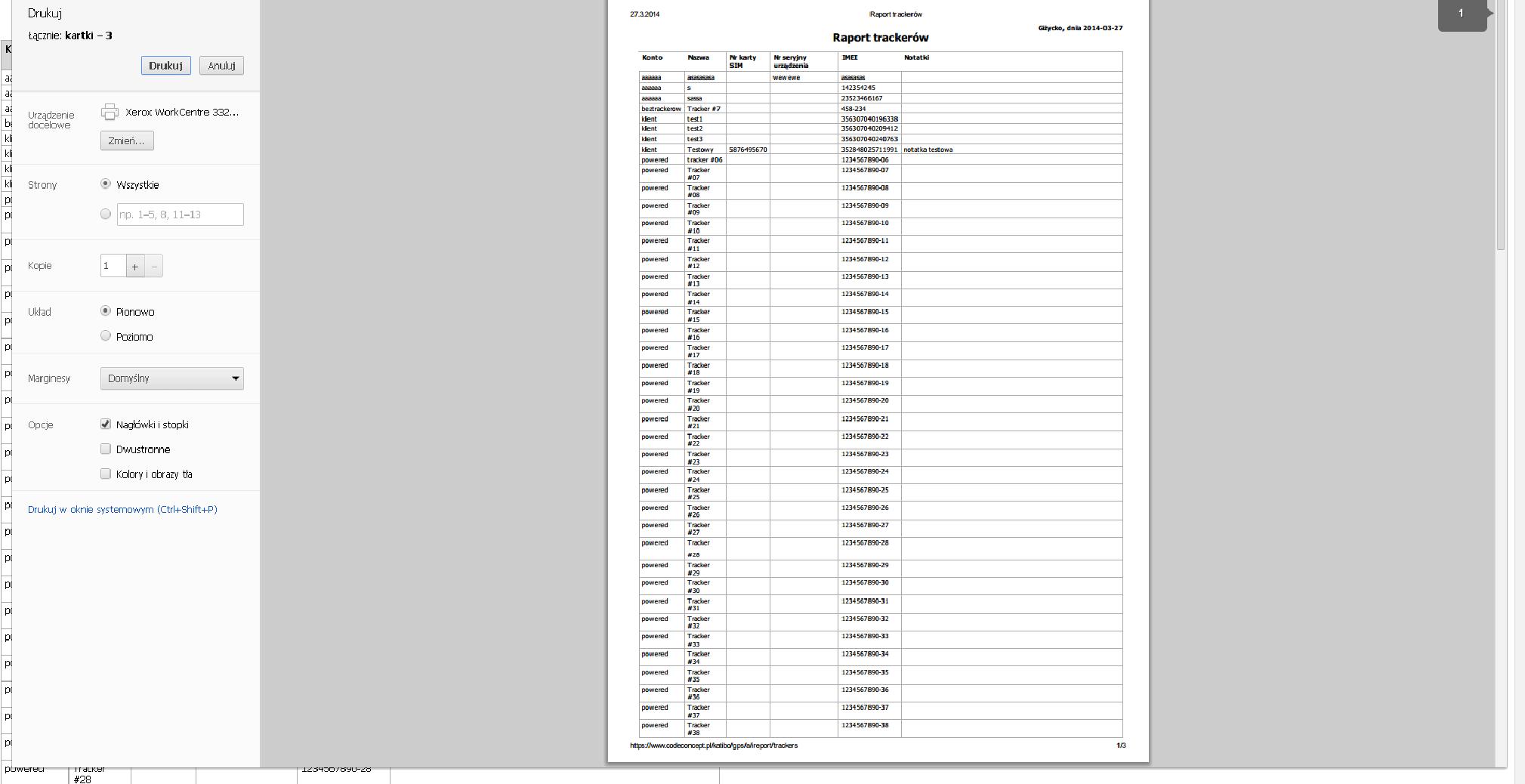
- Storing history data, information is stored for three years na within this period it is possible to use this infomation as trial evidence
- In-built accumulator enables to localize the object for a few hours without any external power supply
SYSTEM DESIGN
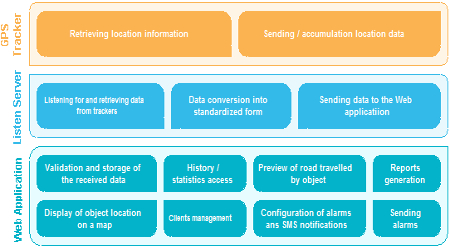
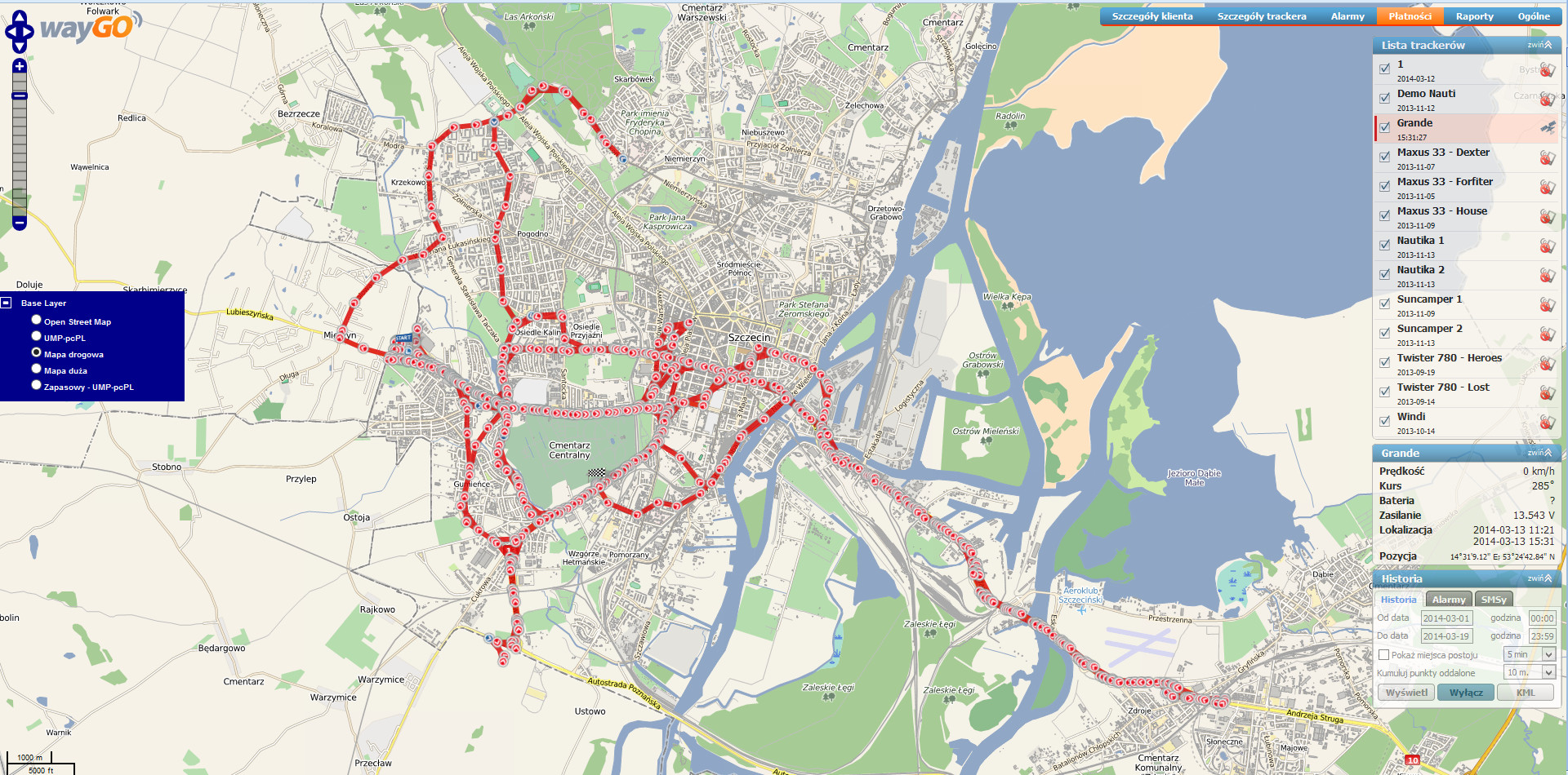
HOW IT WORKS
TRACKER => PC => WEB (=>SMS)
The monitoring system work is based on Global Positioning System (GPS) and GPRS data transfer. Data is sent and processed in three stages:
(Tracker)
Devices (trackers) which are installed in the monitored objects receive location data from the circumterrestial satellites, subsequently the data is analyzed, converted and sent to monitoring system servers. The transfer is realized via GPRS transmissions through mobile GSM networks. In case of being out of range of GSM selected types of devices store location data and information from external sensors in their memory in order to immediately send them collectively when the connection with the server is restored.
(PC)
In real-time, the monitoring server analyses and processes received from a various types of devices data (data is transferred in diverse forms) and then in a homogeneous form it is sent to the destination server (WEB).
(WEB)
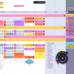
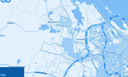
Received data is additionally analyzed. Its corectness and users settings (limits, alarms, subscriptions, etc.) are checked. In case of detecting any predefined event, the server immediately sends an alarm via text message. Types of alarms are created by a user within their subscription using administration panel. Location data is available for a logged user immediately after receiving it( if the account/subscription settings allow it). Route may be seen on a few different maps of user’s choice.
APPLICATION (fleet of vehicles)
Keeping the company cars’ owners fully informed about their fleet
- following owner’s cars in an Internet browser
- determining the vehicle which is the closest to one to delivery reception point
- route optimization
- approximate delivery time
- immediate vehicle localisation in case of breakdown
- fuel consumption decrease
- checking the history of movements and stops’ time
- information sent via text messages
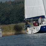
APPLICATION (yachts maintenance)
Optimization of management in case of possessing a few boats or yachts
- predicting yachts arrival at harbour time
- Text message notification in case of any random event
- current information about jachts localization
- avoiding the need to look for a yacht due to breakdown
- reducing the time of yacht arrival at harbour, when the return time is near
- informing sailors about atmosferic conditions in real-time
- increased chance of finding a vehicle/vessel in case of a theft
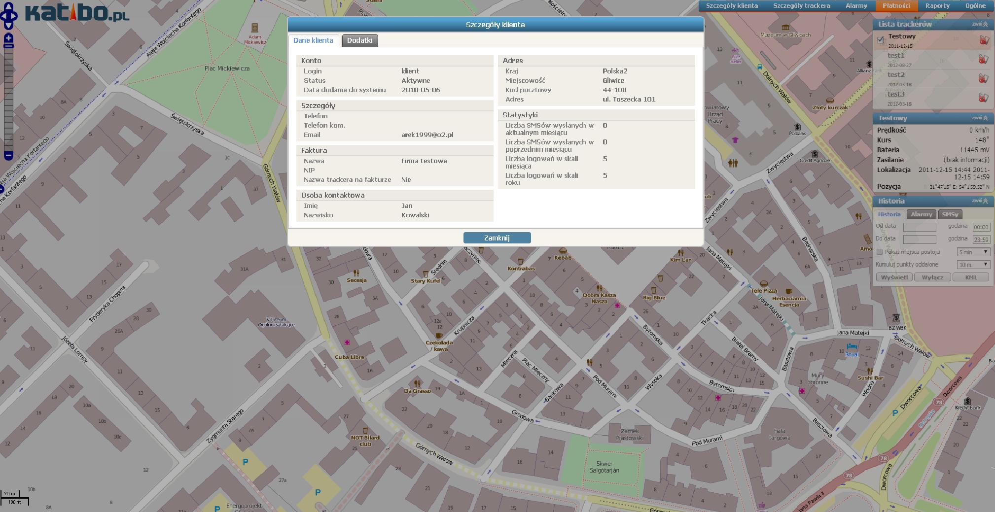
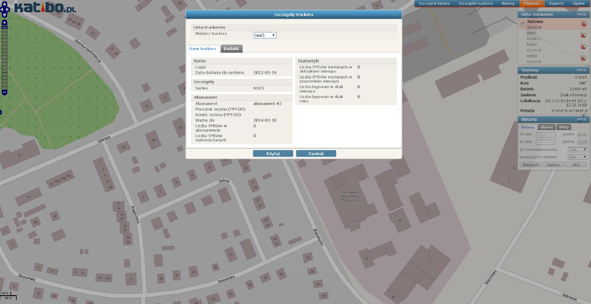
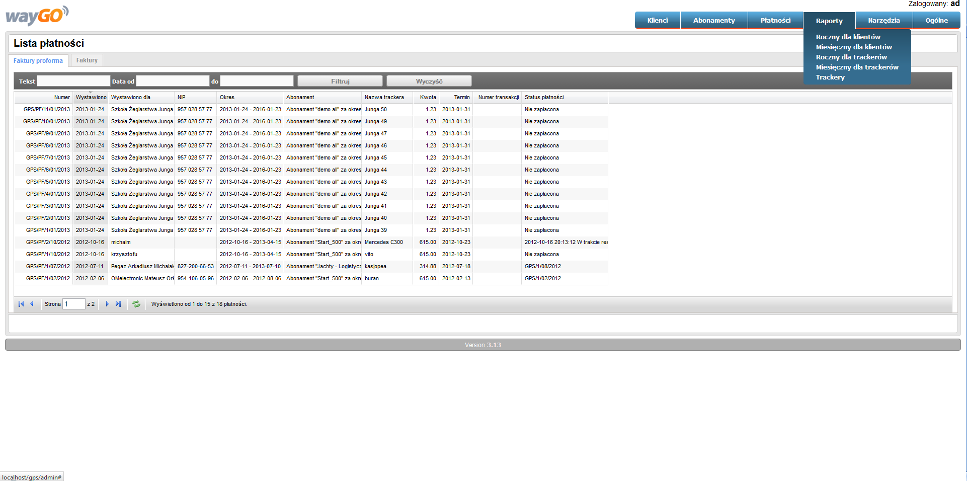
TRACKER MANAGEMENT SYSTEM GSM (vehicles, boats and people monitoring)
- Localization visualisation in WEB network
- Complex user account: payments, invoices, subscriptions
- Alarms and text messages notification
- Possibility to cooperate with multiple map servers
- reports and alarms history generation
- Statistics
PROJECT
Integrated Development Environment:
- WEB – Netbeans
- PC – Visual Studio 2005
Programming language:
- WEB – PHP
- PC – C#